• Hey, guest user. Hope you're enjoying NeoGAF! Have you considered registering for an account? Come join us and add your take to the daily discourse.

March 2 U.S. Severe Weather Outbreak |OT|

Status
Not open for further replies.
Weather is already shaping up to look bad, so thought a thread would be prudent BEFORE the storms start hitting this afternoon.

CURRENT TORNADO WATCHES:
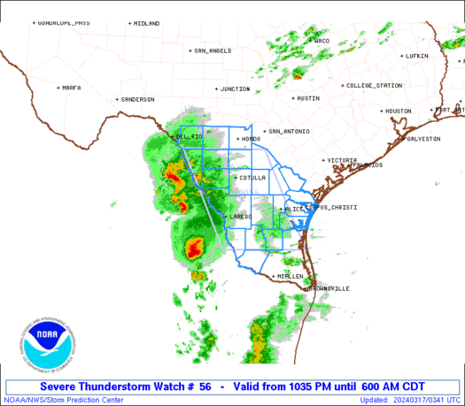
ww0056_radar.gif


SEL6

URGENT - IMMEDIATE BROADCAST REQUESTED
TORNADO WATCH NUMBER 56
NWS STORM PREDICTION CENTER NORMAN OK
930 AM CST FRI MAR 2 2012

THE NWS STORM PREDICTION CENTER HAS ISSUED A
TORNADO WATCH FOR PORTIONS OF

NORTHERN ALABAMA
NORTHWEST GEORGIA
MIDDLE AND EASTERN TENNESSEE


EFFECTIVE THIS FRIDAY MORNING AND AFTERNOON FROM 930 AM UNTIL 300
PM CST.

TORNADOES...HAIL TO 1.5 INCHES IN DIAMETER...THUNDERSTORM WIND
GUSTS TO 70 MPH...AND DANGEROUS LIGHTNING ARE POSSIBLE IN THESE
AREAS.

THE TORNADO WATCH AREA IS APPROXIMATELY ALONG AND 60 STATUTE
MILES EAST AND WEST OF A LINE FROM 50 MILES NORTH NORTHEAST OF
CROSSVILLE TENNESSEE TO 35 MILES SOUTHEAST OF HUNTSVILLE ALABAMA.
FOR A COMPLETE DEPICTION OF THE WATCH SEE THE ASSOCIATED WATCH
OUTLINE UPDATE (WOUS64 KWNS WOU6).


ww0057_radar.gif


SEL7

URGENT - IMMEDIATE BROADCAST REQUESTED
TORNADO WATCH NUMBER 57
NWS STORM PREDICTION CENTER NORMAN OK
955 AM CST FRI MAR 2 2012

THE NWS STORM PREDICTION CENTER HAS ISSUED A
TORNADO WATCH FOR PORTIONS OF

CENTRAL AND SOUTHERN ILLINOIS
CENTRAL AND SOUTHERN INDIANA
WESTERN KENTUCKY
SOUTHEAST MISSOURI


EFFECTIVE THIS FRIDAY MORNING AND EVENING FROM 955 AM UNTIL 600
PM CST.

...THIS IS A PARTICULARLY DANGEROUS SITUATION...

DESTRUCTIVE TORNADOES...LARGE HAIL TO 2.5 INCHES IN DIAMETER...
THUNDERSTORM WIND GUSTS TO 70 MPH...AND DANGEROUS LIGHTNING ARE
POSSIBLE IN THESE AREAS.

THE TORNADO WATCH AREA IS APPROXIMATELY ALONG AND 90 STATUTE
MILES EAST AND WEST OF A LINE FROM 50 MILES SOUTH OF CAPE
GIRARDEAU MISSOURI TO 25 MILES NORTH OF DANVILLE ILLINOIS. FOR A
COMPLETE DEPICTION OF THE WATCH SEE THE ASSOCIATED WATCH OUTLINE
UPDATE (WOUS64 KWNS WOU7).

REMEMBER...A TORNADO WATCH MEANS CONDITIONS ARE FAVORABLE FOR
TORNADOES AND SEVERE THUNDERSTORMS IN AND CLOSE TO THE WATCH
AREA. PERSONS IN THESE AREAS SHOULD BE ON THE LOOKOUT FOR
THREATENING WEATHER CONDITIONS AND LISTEN FOR LATER STATEMENTS
AND POSSIBLE WARNINGS.

Tornado warnings right now across extreme northern Alabama and central Tennessee, moving into eastern Tennessee. Anyone in that Illinois/Missouri/Kentucky/Indiana tornado watch needs to be on guard today because things can get bad real quick.

map_specnews04_ltst_4namus_enus_600x338.jpg


The Weather Channel's TOR:CON index

Friday March 2
AL north - 7
AL central night - 4
AR northeast - 3
GA north night - 3
IL south - 4
IN south - 5
KY central - 9
KY west - 5
KY east - 6
LA north - 3
LA central, southeast night - 3
MO southeast - 3 to 4
MS north - 7
MS central night - 3
NC west night - 3
OH - 3
Southern OH - 4
TN north-central - 9
TN west - 4
TN east - 6
TN south-central - 6
WV west - 4
Other areas - less than 2

TOR:CON Value Descriptions
8:High probability of a tornado
6:Moderate possibility of a tornado
4:Low chance of a tornado nearby, but hail and/or strong wind gusts possible
2:Very low chance of a tornado, but hail and/or strong wind gusts possible
0:Near-zero chance of a tornado or a severe thunderstorm

Remember: if a storm's coming your way, don't try to be a GAF Hero and get pictures.
 

notsol337

marked forever
I live in Dayton, OH. I'm expecting nothing big, other than a storm.

Xenia/Cincinnati on the other hand... :(
 
I am leaving for Cleveland from an hour south of Indianapolis in a couple of hours. It is a seven hour drive.

Am I going to die? Yes/No/Maybe (Circle one)

Shouldn't be a problem. I'm guessing you're going 70 to 71 via Dayton and Columbus, right? If you're going this early there should be no issues.

I live in Dayton, OH. I'm expecting nothing big, other than a storm.

Xenia/Cincinnati on the other hand... :(

I'm on the west side of the state, too. *brofist* Most of the bad stuff that comes our way drifts in from Indiana.
 
West Sub of Chi Town. Nothing to bad coming my way. Hope everyone else stays safe. Mild winter right in fucked up storms, weather is crazy.
 

notsol337

marked forever
Shouldn't be a problem. I'm guessing you're going 70 to 71 via Dayton and Columbus, right? If you're going this early there should be no issues.

Other than having to go around Dayton. Oh god, the horror.

NihonTiger90 said:
I'm on the west side of the state, too. *brofist* Most of the bad stuff that comes our way drifts in from Indiana.

I've noticed that! Darn you, Indiana!

Just kidding. I love Indiana! Twice a year I go out to Indianapolis to watch races.
 

chaosblade

Unconfirmed Member
I'm north of Huntsville. Second tornado in Madison county looked like it went right over where I live on the radar, and it apparently caused damage at/around my high school. Brothers are at school today.

Edit: Sounds like no injuries out there though.
 
New warning in southwestern Virginia:

BULLETIN - EAS ACTIVATION REQUESTED
TORNADO WARNING
NATIONAL WEATHER SERVICE MORRISTOWN TN
1122 AM EST FRI MAR 2 2012

THE NATIONAL WEATHER SERVICE IN MORRISTOWN HAS ISSUED A

* TORNADO WARNING FOR...
RUSSELL COUNTY IN SOUTHWEST VIRGINIA...
EXTREME EASTERN SCOTT COUNTY IN SOUTHWEST VIRGINIA...
WASHINGTON COUNTY IN SOUTHWEST VIRGINIA...
CITY OF BRISTOL IN SOUTHWEST VIRGINIA...

* UNTIL NOON EST

* AT 1118 AM EST...NATIONAL WEATHER SERVICE DOPPLER RADAR INDICATED A
SEVERE THUNDERSTORM CAPABLE OF PRODUCING A TORNADO 11 MILES EAST OF
WEBER CITY...OR 12 MILES WEST OF BRISTOL VA. DOPPLER RADAR SHOWED
THIS TORNADO MOVING EAST AT 60 MPH.

* LOCATIONS IN THE WARNING INCLUDE...
ABINGDON...BENHAMS...HANSONVILLE...HILANDER PARK...HOLSTON...
LINDELL...EMORY-MEADOW VIEW...GLADE SPRING AND KONNAROCK.

NWS is discussing a second PDS tornado watch for western and central Tennessee (Memphis, Nashville)

mcd0207.gif


MESOSCALE DISCUSSION 0207
NWS STORM PREDICTION CENTER NORMAN OK
1028 AM CST FRI MAR 02 2012

AREAS AFFECTED...NERN AR...MO BOOTHEEL...FAR WRN TN...FAR NWRN MS

CONCERNING...SEVERE POTENTIAL...WATCH POSSIBLE

VALID 021628Z - 021730Z

CONVECTIVE INITIATION IS APPEARING MORE LIKELY OVER PARTS OF NERN AR
OVER THE NEXT 1-2 HRS. THE STRONGEST STORMS COULD POSE A THREAT FOR
DMGG WINDS...LARGE HAIL...AND POSSIBLY A TORNADO. CONVECTIVE TRENDS
ARE BEING MONITORED FOR POSSIBLE WW ISSUANCE.

mcd0205.gif


MESOSCALE DISCUSSION 0205
NWS STORM PREDICTION CENTER NORMAN OK
0922 AM CST FRI MAR 02 2012

AREAS AFFECTED...PARTS OF SE MO...SRN IL...SRN IN...WRN AND CNTRL
KY...WRN TN

CONCERNING...SEVERE POTENTIAL...TORNADO WATCH LIKELY

VALID 021522Z - 021715Z

A RAPID INCREASE IN THE SEVERE STORM POTENTIAL APPEARS POSSIBLE BY
MIDDAY...INCLUDING THE RISK FOR STRONG TORNADOES AND VERY LARGE
HAIL.

MODELS INDICATE THAT THE CYCLONIC 500 MB JET CORE IS IN THE PROCESS
OF INTENSIFYING IN EXCESS OF 100 KT...AS ITS EXIT REGION NOSES
ACROSS THE MISSOURI OZARKS TOWARD CENTRAL ILLINOIS THROUGH EARLY
AFTERNOON. STRONGEST MID-LEVEL HEIGHT FALLS WILL BE FOCUSED JUST TO
THE NORTHWEST OF THIS FEATURE...BUT THE SOUTHERN FRINGE OF STRONGER
FORCING FOR UPWARD VERTICAL MOTION APPEARS LIKELY TO WEAKEN
INHIBITION IN THE WARM SECTOR AN ASSOCIATED DEEPENING SURFACE
CYCLONE. AS THE CENTER OF THE LOW TRACKS EAST OF THE MISSISSIPPI
RIVER...AND NORTHEASTWARD THROUGH SOUTHERN ILLINOIS... MODELS
SUGGEST THE DEVELOPMENT AND SHARPENING OF A PRE-COLD FRONTAL DRY
LINE BY THE 17-19Z TIME FRAME...SOUTH OF THE LOW ACROSS SOUTHERN
ILLINOIS INTO THE VICINITY OF THE MISSISSIPPI RIVER. STRENGTHENING
LOW-LEVEL WARM ADVECTION ALONG AND EAST OF THIS FEATURE...COUPLED
WITH WEAK TO MODERATE BOUNDARY LAYER DESTABILIZATION BENEATH THE
MID-LEVEL DRY SLOT...MAY SERVE TO FOCUS THE INITIATION OF DISCRETE
STORMS. IN THE PRESENCE OF VERY STRONG SHEAR...AND LARGE CLOCKWISE
CURVED LOW-LEVEL HODOGRAPHS BENEATH A 50+ KT SOUTHWESTERLY 850 MB
JET...THE ENVIRONMENT WILL BE CONDUCIVE TO LONG-LIVED SUPERCELLS.

VERY LARGE HAIL IS POSSIBLE FROM THE OUTSET...AND TORNADIC POTENTIAL
MAY ALSO INCREASE QUICKLY...WITH POTENTIAL FOR PARTICULARLY STRONG
AND DAMAGING TORNADOES INCREASING THROUGH THE AFTERNOON. GIVEN THE
STRENGTH OF THE DEEP LAYER WESTERLY MEAN FLOW /50-60+ KT/...CELLS
WILL BE FAST MOVING...BUT ADDITIONAL STRONG/SEVERE STORMS COULD
DEVELOP IN ITS WAKE...AS THE COLD FRONT OVERTAKES THE DRY LINE EAST
OF THE MISSISSIPPI VALLEY LATER THIS AFTERNOON.

Storm watch likely for the entire state of Ohio, possibly even a tornado watch:

mcd0208.gif


AREAS AFFECTED...PARTS OF ERN IND...NERN KY...MUCH OF OH AND
ADJACENT WEST VIRGINIA

CONCERNING...SEVERE POTENTIAL...WATCH LIKELY

VALID 021630Z - 021800Z

A WATCH IS NOT NECESSARILY ANTICIPATED IN THE NEAR TERM...BUT ONE
PROBABLY WILL BE NEEDED LATER THIS AFTERNOON.

THE SEVERE HAIL POTENTIAL ASSOCIATED WITH STORMS SPREADING
NORTHEASTWARD WITHIN AN ELEVATED WARM ADVECTION REGIME...IN ADVANCE
OF THE SURFACE WARM FRONT LIFTING NORTHWARD THROUGH THE OHIO
VALLEY...MAY BE LIMITED ENOUGH TO PRECLUDE A SEVERE THUNDERSTORM
WATCH ISSUANCE. HOWEVER...THE RISK FOR SEVERE STORMS IS EXPECTED TO
INCREASE LATER THIS AFTERNOON...AS THE WARM SECTOR OF A DEEP SURFACE
CYCLONE...MIGRATING NORTHEAST OF THE MIDDLE MISSISSIPPI VALLEY INTO
THE GREAT LAKES REGION...ADVECTS NORTHEAST OF THE LOWER OHIO VALLEY.
AT THE PRESENT TIME...IT APPEARS THAT A TORNADO WATCH COULD BECOME
NECESSARY CLOSER TO THE 21-22Z TIME FRAME.
 
I live in Dayton, OH. I'm expecting nothing big, other than a storm.

Xenia/Cincinnati on the other hand... :(

I am in Dayton as well. I am not expecting anything major considering the storm seems to be moving north. We are about to get hit with the first line soon though.
 

notsol337

marked forever
I am in Dayton as well. I am not expecting anything major considering the storm seems to be moving north. We are about to get hit with the first line soon though.

I'm tracking it on radar. I'm sitting in Belmont, just waiting to go to work in Kettering. I go in around 3.30, so I will be in a strip mall during the worst times of the storm.

Not looking forward to this.
 
I feel like with all this climate change, it's only a matter of time before my St. Louis house is ripped apart by a tornado.

Sounds extreme, but we have had increasingly severe storms the last few years and some homes were destroyed last year that were wayyyy too close to mine.
 
Help me, GAF. If I have to go to an inside room i'll have to camp out in the pantry. At least I can eat while I await oblivion.

oh shit, there goes the siren.
 

Credo

Member
I live in AL. Not sure when the storms will be hitting here, but probably early/late afternoon.

Unless it has been changed, the window for severe weather for us is from 2 PM to 2 AM.

I'm just hoping we don't get a repeat of April 27, 2011.
 

Muddimar

Member
Cincinnati here. According to the weather channel I have to wait until 5-8pm to experience the madness. Stay safe midwest GAF!
 

Seth C

Member
I'm right in the center of this in Lexington, KY. I'll keep you all updated. Apparently Al Roker and the Storm Chasers have setup shop in town in anticipation, and FEMA is here. The mayor has urged businesses to close early.

We shall see.
 

notsol337

marked forever
I expect my job at RadioShack today will end with me telling people we're out of flashlights, weather radios, and d-cell batteries.

That's what usually happens with storms.
 

ced

Member
Is the Florida panhandle supposed to get this tomorrow? Everything I've read seems to indicate Tstorms but no mention of the tornado chances.
 
New PDS Tornado Watch:

ww0058_radar_init_resize.gif


THE NWS STORM PREDICTION CENTER HAS ISSUED A
TORNADO WATCH FOR PORTIONS OF

CENTRAL AND SOUTHERN INDIANA
CENTRAL AND EASTERN KENTUCKY
SOUTHWEST OHIO


EFFECTIVE THIS FRIDAY AFTERNOON AND EVENING FROM 105 PM UNTIL 900
PM EST.

...THIS IS A PARTICULARLY DANGEROUS SITUATION...

DESTRUCTIVE TORNADOES...LARGE HAIL TO 2.5 INCHES IN DIAMETER...
THUNDERSTORM WIND GUSTS TO 70 MPH...AND DANGEROUS LIGHTNING ARE
POSSIBLE IN THESE AREAS.

THE TORNADO WATCH AREA IS APPROXIMATELY ALONG AND 105 STATUTE
MILES EAST AND WEST OF A LINE FROM 25 MILES NORTH NORTHEAST OF
DAYTON OHIO TO 30 MILES SOUTHEAST OF BOWLING GREEN KENTUCKY. FOR
A COMPLETE DEPICTION OF THE WATCH SEE THE ASSOCIATED WATCH
OUTLINE UPDATE (WOUS64 KWNS WOU8).

REMEMBER...A TORNADO WATCH MEANS CONDITIONS ARE FAVORABLE FOR
TORNADOES AND SEVERE THUNDERSTORMS IN AND CLOSE TO THE WATCH
AREA. PERSONS IN THESE AREAS SHOULD BE ON THE LOOKOUT FOR
THREATENING WEATHER CONDITIONS AND LISTEN FOR LATER STATEMENTS
AND POSSIBLE WARNINGS.

This includes the cities of:

Cincinnati, Ohio
Dayton, Ohio
Columbus, Ohio
Muncie, Indiana
Louisville, Kentucky
Lexington, Kentucky
Bowling Green, Kentucky

I'm barely north of this (the dot up there that says Findlay is where I am) so I'll be preparing all the same.
 

thefro

Member
Updated TOR:CON, definitely has gotten worse

Friday March 2
AL north - 7
AL central, southwest night - 4
GA north - 5
GA central night - 4
IL south - 8
IN south half - 8
KY central, east - 9
KY west - 4
LA northeast, central - 3
LA south night - 3
MO southeast - 4
MS north - 7
MS central - 5
MS south night - 3
NC west - 5
NC central night - 3 to 4
OH south - 8
OH central, northeast - 3 to 4
PA west - 3 to 4 evening/night
SC west, central - 3 to 4
TN middle, east - 9
TN west - 4
VA southwest - 5
VA central night - 3 to 4
WV west, central - 4 to 5
other areas - less than 2

Looks like a huge cell just blew up right outside Indianapolis
 
Damage reported in Chattanooga/Hamilton County, Tennessee.

New tornado watch for western Tennessee, Mississippi and Alabama:

BULLETIN - IMMEDIATE BROADCAST REQUESTED
TORNADO WATCH OUTLINE UPDATE FOR WT 59
NWS STORM PREDICTION CENTER NORMAN OK
120 PM CST FRI MAR 2 2012

TORNADO WATCH 59 IS IN EFFECT UNTIL 900 PM CST FOR THE
FOLLOWING LOCATIONS

ALC009-033-043-049-057-059-071-073-075-077-079-083-089-093-095-
103-107-125-127-133-030300-
/O.NEW.KWNS.TO.A.0059.120302T1920Z-120303T0300Z/

AL
. ALABAMA COUNTIES INCLUDED ARE

BLOUNT COLBERT CULLMAN
DEKALB FAYETTE FRANKLIN
JACKSON JEFFERSON LAMAR
LAUDERDALE LAWRENCE LIMESTONE
MADISON MARION MARSHALL
MORGAN PICKENS TUSCALOOSA
WALKER WINSTON


MSC003-007-009-013-015-017-019-025-043-051-053-057-071-081-087-
093-095-097-103-105-115-117-125-139-141-145-155-159-161-163-
030300-
/O.NEW.KWNS.TO.A.0059.120302T1920Z-120303T0300Z/

MS
. MISSISSIPPI COUNTIES INCLUDED ARE

ALCORN ATTALA BENTON
CALHOUN CARROLL CHICKASAW
CHOCTAW CLAY GRENADA
HOLMES HUMPHREYS ITAWAMBA
LAFAYETTE LEE LOWNDES
MARSHALL MONROE MONTGOMERY
NOXUBEE OKTIBBEHA PONTOTOC
PRENTISS SHARKEY TIPPAH
TISHOMINGO UNION WEBSTER
WINSTON YALOBUSHA YAZOO


TNC003-005-015-017-021-023-027-031-033-035-037-039-041-043-047-
049-051-053-055-061-069-071-075-077-079-081-083-085-087-099-101-
103-109-111-113-117-119-125-127-133-135-137-141-147-149-159-161-
165-169-175-177-181-183-185-187-189-030300-
/O.NEW.KWNS.TO.A.0059.120302T1920Z-120303T0300Z/

TN
. TENNESSEE COUNTIES INCLUDED ARE

BEDFORD BENTON CANNON
CARROLL CHEATHAM CHESTER
CLAY COFFEE CROCKETT
CUMBERLAND DAVIDSON DECATUR
DE KALB DICKSON FAYETTE
FENTRESS FRANKLIN GIBSON
GILES GRUNDY HARDEMAN
HARDIN HAYWOOD HENDERSON
HENRY HICKMAN HOUSTON
HUMPHREYS JACKSON LAWRENCE
LEWIS LINCOLN MACON
MADISON MARSHALL MAURY
MCNAIRY MONTGOMERY MOORE
OVERTON PERRY PICKETT
PUTNAM ROBERTSON RUTHERFORD
SMITH STEWART SUMNER
TROUSDALE VAN BUREN WARREN
WAYNE WEAKLEY WHITE
WILLIAMSON WILSON


ATTN...WFO...BMX...OHX...MEG...HUN...JAN...

Possible rotation north of Indianapolis heading towards Carmel and Fishers.
 
Calmly awaiting the storm to hit in Bloomington, IN. It just feels like severe weather outside.

Sucks being in a second story apartment.
 
Shit... I had no idea this was coming out way. Get your tornado gear ready, Indiana/Ohio/Kentucky GAF. Popcorn bowl on my head, duct-taped pillows on my arms and chest. Let's do this.
 

notsol337

marked forever
Cool, now we're at tor:con 8! I still think Dayton will be ok, but my entire family is down around the Cincinnati/Hamilton area.

Hopefully this is all undue concern...
 
Damn the cell that is producing a tornado in Indiana is heading right for my area in Ohio. It might arrive around rush hour too, this really sucks.
 

ReBurn

Gold Member
The storms will be rolling in some time tonight. The good news is that the rain temporarily washes the pollen from the air, which is good because all of these pine trees are killing my allergies.
 

Nevasleep

Member
Updated TOR:CON, definitely has gotten worse

Friday March 2
AL north - 7
AL central, southwest night - 4
GA north - 5
GA central night - 4
IL south - 8
IN south half - 8
KY central, east - 9
KY west - 4
LA northeast, central - 3
LA south night - 3
MO southeast - 4
MS north - 7
MS central - 5
MS south night - 3
NC west - 5
NC central night - 3 to 4
OH south - 8
OH central, northeast - 3 to 4
PA west - 3 to 4 evening/night
SC west, central - 3 to 4
TN middle, east - 9
TN west - 4
VA southwest - 5
VA central night - 3 to 4
WV west, central - 4 to 5
other areas - less than 2

Looks like a huge cell just blew up right outside Indianapolis

TOR:CON Value Descriptions
8:High probability of a tornado
6:Moderate possibility of a tornado
4:Low chance of a tornado nearby, but hail and/or strong wind gusts possible
2:Very low chance of a tornado, but hail and/or strong wind gusts possible
0:Near-zero chance of a tornado or a severe thunderstorm
 
Girls are already home from school in Fayette Co (Lexington) -- the let out 2 hours early since the original projection was for storms to start showing up around dismissal. This is of course also when my wife will be driving home. Storms seem to be moving a bit slower so hopefully she beats the system home.

Odd week for KY weather, hometown was hit on Wed (thankfully no-one hurt) and we were under alert here as well, and now we are gearing up for another day/evening of it.

Stay safe flyover-GAF.
 
Status
Not open for further replies.
Top Bottom