-
Hey, guest user. Hope you're enjoying NeoGAF! Have you considered registering for an account? Come join us and add your take to the daily discourse.
You are using an out of date browser. It may not display this or other websites correctly.
You should upgrade or use an alternative browser.
You should upgrade or use an alternative browser.
Potential NE/MA Snow Storm 2.0 Monday - Wednesday
- Thread starter Butts-a-plenty
- Start date
- Status
- Not open for further replies.
plagiarize
Banned
Fuck it, bring it on. Nothing will top last year, but at least this year I've committed to making something of a shoveling playlist.
Yep. I brandish my snow shovel with pride. If I didn't get tired of digging out last winter. I'm certainly not going to get tired of it this one.
GregLombardi
Member
Tomorrow's snow will be bad simply because the heaviest of it will hit during morning rush hour.
4-7 inches at best isn't massive. It's not great, but compared to last year it's nothing.
That is not what the models are saying. A lot of people that stay snow are getting a foot.
GFS run from earlier today. Three of these maps you need pay attention to. The top right, the top left, and bottom right. Top left shows the upper levels (500mb). Top right shows the surface level pressures and centers. Bottom right shows the precipitation shield of the expected storm.
Top left is the reason why this storm could be a monster. The dark red shows a lot of energy which could be pumped into the storm, making the storm to possibly undergo bombogenesis (a drop of 24+ millibars in 24 hours). That said, the upper levels are still neutral, which would push this storm quickly out to sea after tracking north for a few hours.
Top right is the reason why this storm will likely not produce for NYC and points south (DC, Baltimore, and Philly). The secondary low forms way too far north. It basically forms over New York Harbor. For places like NYC and NNJ to see significant snow, the secondary low needs to form further south. I don't think that'll happen.
Bottom right shows why the storm will bomb out, but not for areas like DC, NJ, Philly, NYC and maybe even Boston. By the time this storm reaches us, I wouldn't be surprised to see it only impact northern Massachusetts and the Gulf of Maine.
wild wild rice
Member
Yes. Tomorrow looks to be a 3-6 inch event in NYC and a 6-10 inch event in central Mass.
Really? Damn. Weather.gov says I'm not getting anything in the Hudson Valley, weather.com says less than 1 inch.
Really? Damn. Weather.gov says I'm not getting anything in the Hudson Valley, weather.com says less than 1 inch.
Hudson Valley is way too far north for tomorrow's event. NYC and east see snow. Hudson Valley sees flurries.
Anoregon
The flight plan I just filed with the agency list me, my men, Dr. Pavel here. But only one of you!
bombogenesis
what a good word
*snip*
Cool stuff. Out of curiosity do you follow this stuff as a hobby? Field of study? Work-related?
Fascinated by meterology, and bombogenesis is a fucking awesome word.
Ivan Amiibo
Banned
can this shit come to the midwest please, i like snow
JacksUsername
Member
Please no. Driving up to Boston on Wednesday to see Pippin.
teruterubozu
Member
bostonchannel says 2-4 for my region tomorrow, I wan't 3-6 at least, come on... snow snow snow
6 inches tomorrow here in Maine. I'm not even thinking about the storm in this thread.
Cool stuff. Out of curiosity do you follow this stuff as a hobby? Field of study? Work-related?
Hobby and field of study. As I kid, I would tune into the Weather Channel like a normal kid would watch Nickelodeon.
In other news the short term models are now showing a big surprise for some people in the Northeast tomorrow morning. Some areas along coast could see thundersnow and 3 inches/hour before this wave moves out to sea.
Oh no, not again
That little gold blip is my driver side rear view the day after the recent storm. I just want Spring to be here already.

That little gold blip is my driver side rear view the day after the recent storm. I just want Spring to be here already.
Butts-a-plenty
Banned
Hobby and field of study. As I kid, I would tune into the Weather Channel like a normal kid would watch Nickelodeon.
In other news the short term models are now showing a big surprise for some people in the Northeast tomorrow morning. Some areas along coast could see thundersnow and 3 inches/hour before this wave moves out to sea.
DC rush hour is gonna blow. Glad I take the metro.
BronsonLee
Member
It's time.

Butts-a-plenty
Banned
Boston Public Schools closed tomorrow. Here's hoping for a day off. If Cambridge closes we usually follow.
Seems like this kind of came out of nowhere.
There is tonights storm and the potentially bigger one early next week.
It's time.
Cold snap and a long commute for me please.
There is tonights storm and the potentially bigger one early next week.
Yeah I know, I was talking about tonight and tomorrow's storm. Usually the news can't wait to broadcast potential storms 5-7 days out but this seems to have snuck up.
Bourbon is the only snowstorm booze you need.
Butts-a-plenty
Banned
Yeah I know, I was talking about tonight and tomorrow's storm. Usually the news can't wait to broadcast potential storms 5-7 days out but this seems to have snuck up.
Bourbon is the only snowstorm booze you need.
Bourbon is good until it goes on forever...Only Yuengling can sustain then.
Hobby and field of study. As I kid, I would tune into the Weather Channel like a normal kid would watch Nickelodeon.
In other news the short term models are now showing a big surprise for some people in the Northeast tomorrow morning. Some areas along coast could see thundersnow and 3 inches/hour before this wave moves out to sea.
Yep, locally (Nashua, NH) is real close to that "Eh, not much/OH SHIT" line, guess it's case of we'll see what lands when it lands...
BronsonLee
Member
Tomorrow morning should be interesting, but it'll be quick. It'll be just above a nuisance event. 2-4 DC to NJ. 4-10 NYC to Boston. Boston could see over a foot.
Where the hell did this come from?!
Lord_Byron28
Member
I'm in the 12-18 inch range. Im just going to hope we don't get more than 6 inches.GGEM

Tomorrow morning should be interesting, but it'll be quick. It'll be just above a nuisance event. 2-4 DC to NJ. 4-10 NYC to Boston. Boston could see over a foot.
Really, over a foot? I've done my typical pre-storm routine of getting pretty drunk in anticipation of a snow day. Backfires quite often.
Where the hell did this come from?!
nooo
Lionheart1827
Member
Oh, come ON. Long Island just got rid of the last bunch!
Haha seriously. At least it's on a Friday this time

Well, at least it won't be as bad as 1.0
Marylander reporting in, buying liquor this weekend just in case
some people hit the stores to fight over bread and milk and toilet paper with no idea if they'll need it. Other people hit the liquor store to stock up on beer, whiskey, and then order a couple pizzas, with full intention to use all of it.
ph1l0z0ph3r
Member
Only saw 1-3 inches in Western Mass. Hopefully we get double that atleast. Some sledding and snowboarding this weekend would be fun.
Where the hell did this come from?!
It's been there for about a day. Meteorologists were certain the system would get stronger and snowier on model runs as the system got closer because of how warm the water is for this time of year. The major models have a difficult time picking up that type of strengthening up.
Slayer-33
Liverpool-2
It's been there for about a day. Meteorologists were certain the system would get stronger and snowier on model runs as the system got closer because of how warm the water is for this time of year. The major models have a difficult time picking up that type of strengthening up.
Still has a chance to be crazier by the time it starts? Here in nyc?
Still has a chance to be crazier by the time it starts? Here in nyc?
No. The 4-10 from NYC to Boston seems about right. NYC will likely be 3-6. More snow as you head east of there.
The 6z GFS was slightly more south this run, but I'm still not sold on this thing producing for areas south and west of Cape Cod. Until other OP models are on board, I'm still out. That said, there were some interesting developments on the ensemble runs of the GFS and EURO yesterday. A number of them show a bombing out low just north of the Outer Banks. If that begins to show up consistently on the models, and the upper trough agrees with that, we're in business in NYC to possibly Philly.
Below is the surface level pressure of the storm as it redevelops near the coast on the 6z GFS.

Below is the surface level pressure of the storm as it redevelops near the coast on the 6z GFS.
The Albatross
Member
Well I'm headed into Boston for mini-storm 2016. Wish me luck.
Nabs
Member
Well I'm headed into Boston for mini-storm 2016. Wish me luck.
Be safe. It's starting to turn nasty with a rain/snow mix.
ActStriker
Member
Around 7:15 when I left for work from Boston it was snowing but still pretty wet.
Four_Chamber
Member
Ugh, stay safe
Icefire1424
Member
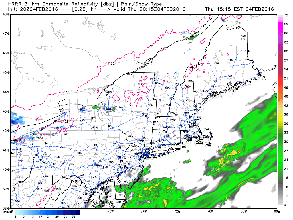
Not storm related, but walked out the door this morning in Syracuse to a pretty intense snow squall that lasted all of three minutes.
Glad we're not expecting anything major. Mother in law coming up this weekend and I'd rather not be stuck in the house with everybody for a few days.
Also, I think we need a new brew for this storm.
Glad we're not expecting anything major. Mother in law coming up this weekend and I'd rather not be stuck in the house with everybody for a few days.
Also, I think we need a new brew for this storm.
- Status
- Not open for further replies.